The Dempster Highway is a gravel road that runs about 740 km (460 mi) from the North Klondike Highway near Dawson City, Yukon, to Inuvik in the Northwest Territories. It is the only public road in Canada that crosses the Arctic Circle. From Inuvik, the Inuvik–Tuktoyaktuk Highway continues another 138 km to the Arctic Ocean.
The road passes through Tombstone Territorial Park, the Ogilvie and Richardson mountains, and the Peel and Mackenzie river valleys. There are only a few places to buy fuel, two river crossings by ferry or ice road in the N.W.T., and long stretches with no services or cell coverage. This page covers what to know before you go, a stop-by-stop road log, campgrounds and common questions.
Dempster Highway: key facts
| Length |
About 740 km (460 mi), Dempster Corner to Inuvik. The first 465 km are in the Yukon. |
| Start |
Dempster Corner, at km 674 of the North Klondike Highway, about 40 km (25 mi) east of Dawson City |
| End |
Inuvik, N.W.T. The Inuvik–Tuktoyaktuk Highway (N.W.T. Highway 10) continues 138 km to Tuktoyaktuk. |
| Highway numbers |
Yukon Highway 5 · N.W.T. Highway 8 |
| Surface |
Gravel, except a short paved section at each end |
| Season |
Open all year. N.W.T. river crossings use free ferries in summer and ice roads in winter, and close for several weeks at freeze-up and break-up. |
| Fuel |
Dempster Corner cardlock (km 0) · Eagle Plains (km 369) · Fort McPherson · Inuvik · Tuktoyaktuk |
| Longest gap without fuel |
About 369 km, Dempster Corner to Eagle Plains |
| Driving time |
Plan on two days each way. Allow longer if you stop to hike or camp. |
| Road conditions |
511 Yukon (Yukon section) · DriveNWT (N.W.T. section and ferries) |
Kilometres are approximate. Yukon figures follow Government of Yukon kilometre posts. In the N.W.T. the posts start again at 0 at the border. Last updated: October 2026.
Planning your drive
Fuel
Fill your tank in Dawson City and top up at the cardlock at Dempster Corner. The cardlock is unstaffed and takes cards only. The next fuel is at Eagle Plains, about 369 km north. In the N.W.T. you can buy fuel in Fort McPherson and Inuvik. Tuktoyaktuk has gas and diesel but no propane. Many drivers carry a jerry can as a backup.
Tires and road surface
The road is built on a thick gravel pad that keeps the permafrost underneath frozen. Some sections use sharp shale, and flat tires are common. Carry two full-size spare tires and the tools to change them. Expect dust in dry weather, slick mud after rain, potholes and loose gravel, especially between Fort McPherson and Tsiigehtchic. Slow down and move right when trucks pass to save your windshield.
Ferries and ice roads
There are two river crossings in the N.W.T., and both are free:
- Peel River (N.W.T. km 74), near Fort McPherson. Regular hours are 9:15 a.m. to 12:45 a.m.
- Mackenzie River (N.W.T. km 143), at Tsiigehtchic. Regular hours are 8:15 a.m. to 11:15 p.m. The ferry also stops at Tsiigehtchic if you ask the crew.
The ferries usually start in early June and run until late October or early November. In winter, ice roads take their place, usually from December or early January. Between the two seasons, while the rivers freeze or thaw, you can’t cross at all, and the road north of the Peel is cut off for several weeks. Ferries can close with little notice for ice, low water or high wind, so check DriveNWT before you leave Dawson City.
When to go
Most people drive the Dempster from June to early September, when the ferries are running and the campgrounds are open. Tundra colours peak in late August and early September. The road stays open in winter, but expect extreme cold, blowing snow, short days and road closures. In winter, travel only with a vehicle and gear set up for Arctic conditions.
Wildlife and safety
You may see caribou, grizzly bears, moose, Dall’s sheep, foxes, wolves and many birds of prey. Stay in your vehicle when you watch bears, and keep well back from falcon nests on the cliffs. Carry bear spray when you hike or camp. Do not feed any wildlife.
There is no cell service along most of the highway. Tell someone your plans, and consider carrying a satellite messenger. Drive with your headlights on, and don’t stop on hills, bridges or curves.
Time zone
The Yukon stays on the same time all year. The N.W.T. moves its clocks ahead in summer, so from spring to fall, Inuvik is one hour ahead of Dawson City.
What to bring
- Two full-size spare tires, a jack and a tire repair kit
- Extra fuel, water and food for at least a day
- Warm clothes and a sleeping bag, even in summer
- Bear spray, insect repellent and a first aid kit
- A printed map. Phones and GPS may not work for long stretches.
Dempster Highway road log
Kilometres are measured from Dempster Corner. In the N.W.T., the kilometre posts start again at 0 at the border, so N.W.T. entries show both the post number and the total distance from Dempster Corner.
Dempster Corner to Tombstone Territorial Park (km 0 to 120)
- Km 0, Dempster Corner. Junction with the North Klondike Highway, about 40 km east of Dawson City. Cardlock fuel (cards only). The pavement ends a few kilometres north.
- Km 50 to 120, Tombstone Territorial Park. The highway runs through the park for about 70 km. There are no stores, fuel or phones in the park.
- Km 58.5, Grizzly Ridge trailhead. A day hike to a ridge with views of Mount Monolith. Grizzly Lake, further in, is an overnight trip that needs a reservation.
- Km 71.5, Tombstone Interpretive Centre. Open daily in summer (May 16 to September 20 in 2026). Staff have trail, wildlife and road updates. A short trail connects it to the campground.
- Km 72, Tombstone Mountain Campground. The largest campground on the highway, with 51 sites, including walk-in tent sites and group sites. Some sites can be reserved online. It often fills up in July and August.
- Km 74, Tombstone Range viewpoint. A pullout with a view up the North Klondike River valley to the granite peaks of the Tombstone Range.
- Km 80, North Fork Pass. The highest point on the Dempster. Water to the south drains to the Yukon River and the Bering Sea, and water to the north drains to the Mackenzie River and the Beaufort Sea. Dall’s sheep lamb on the nearby slopes in May and June, so hike elsewhere at that time.
- Km 107.6, Blackstone River pullout. A rest stop beside the river.
- Km 116, Chapman Lake. The largest lake along the highway, and a good place to see waterbirds. Construction stopped here for several years in the 1960s.
- Km 117, Dempster plaque. A marker for the Mounted Police patrols between Dawson City and Fort McPherson, and for Inspector W.J.D. Dempster.
Tombstone to Eagle Plains (km 120 to 369)
- Km 152.8, Windy Pass. A high tundra pass. Watch for caribou trails on the slopes ahead.
- Km 168 to 193, Engineer Creek valley. The water here is high in minerals and has a sulphur smell. Don’t drink it. Dall’s sheep come down to the creek to lick the minerals.
- Km 193, Engineer Creek Campground. 11 sites below Sapper Hill, a group of dolomite cliffs. A short route leads to the cliffs, where peregrine falcons often nest.
- Km 196, Ogilvie River bridge. The bridge was built by Canadian Army engineers. There is a highway maintenance camp nearby, but no visitor services. Staff can help only in an emergency.
- Km 200 to 225, Ogilvie River valley. Watch for rock towers (tors) on the slopes. Elephant Rock is visible across the river from the pullout at km 221.
- Km 245.5, Seven Mile Hill. The road climbs out of the valley onto the Eagle Plain plateau and crosses the continental divide for the second time.
- Km 259, Ogilvie Ridge viewpoint. A rest area with a wide view over the Ogilvie and Peel river valleys and the northern Ogilvie Mountains.
- Km 260 to 369, Eagle Plain. Rolling hills with thin black spruce. Permafrost makes many trees lean in different directions, which is why people call it a “drunken forest”.
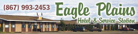
- Km 369, Eagle Plains Hotel and Service Station. Close to halfway to Inuvik and open all year. Gas, diesel and propane, tire and minor repairs, rooms, a restaurant and lounge, showers, laundry and a campground with RV sites. Photos in the hotel tell the stories of the Lost Patrol and the Mad Trapper.
Eagle Plains to the N.W.T. border (km 369 to 465)
- Km 378, Eagle River bridge. The bridge sits on piles driven deep into the permafrost.
- Km 405.5, Arctic Circle. A signed pullout with interpretive panels at 66°33′ N. North of here, the sun stays above the horizon around the June solstice.
- Km 405 to 465, Richardson Mountains. Open tundra with long views. The Porcupine caribou herd winters here, and grizzly bears are often seen in summer.
- Km 446, Rock River Campground. 17 sites in a sheltered, wooded valley. It is the last Yukon campground before the border.
- Km 465, Yukon–N.W.T. border and Wright Pass. A rest stop with interpretive panels at the third crossing of the continental divide. The highway becomes N.W.T. Highway 8, and the kilometre posts start again at 0.
N.W.T. border to Fort McPherson (N.W.T. km 0 to 86)
- N.W.T. km 14 (km 479), James Creek. A highway maintenance camp with no visitor services. The creek has good grayling fishing.
- N.W.T. km 44 (km 509), Midway Lake. Site of the Midway Lake Music Festival, held each year in early August.
- N.W.T. km 71 (km 536), Tetlit Gwinjik viewpoint. A day-use area with a view over the Peel River, the Mackenzie Delta and Fort McPherson.
- N.W.T. km 74 (km 539), Peel River ferry. Free, on demand. Ice road in winter. No crossing during freeze-up or break-up.
- N.W.T. km 76 (km 541), Nataiinlaii Territorial Park. 22 non-powered sites on a bluff above the Peel River, with showers and a visitor centre about Gwich’in life. First come, first served. Register at the visitor centre.
- N.W.T. km 86 (km 551), Fort McPherson. A Tetlit Gwich’in community with fuel, a store and an RCMP detachment. The Fort McPherson Tent and Canvas shop is here, and the graves of the Lost Patrol are in the churchyard.
Fort McPherson to Inuvik (N.W.T. km 86 to 270)
- N.W.T. km 143 (km 608), Mackenzie River ferry and Tsiigehtchic. Free. The ferry crosses the Mackenzie near where the Arctic Red River joins it. Ask the crew if you want to stop at Tsiigehtchic, a small Gwich’in community. Ice road in winter.
- N.W.T. km 178 (km 643), Rengling River. A picnic spot with grayling fishing.
- N.W.T. km 221 (km 686), Vadzaih Van Tshik Campground. Nine non-powered sites beside Caribou Creek, at the south end of Gwich’in Territorial Park. Register at the kiosk.
- N.W.T. km 226 (km 691), Tithegeh Chii Vitaii lookout. A short walk to cliffs above Campbell Lake. Watch for peregrine falcons.
- N.W.T. km 240 (km 705), Gwich’in Territorial Campground. 25 non-powered sites and 11 tent sites on Campbell Lake, with a boat launch. First come, first served.
- N.W.T. km 244 (km 709), Ehjuu Njik day-use area. Picnic tables on Cabin Creek, with grayling fishing.
- N.W.T. km 254 (km 719), Nihtak day-use area. Access to Campbell Lake. Whitefish run up the creek in spring.
- About N.W.T. km 260, airport junction. The road is paved from here. Turn left for the Inuvik airport or right for town.
- N.W.T. km 266 (km 731), Jàk Territorial Park. 10 powered and 27 non-powered sites just south of Inuvik, with showers and a lookout tower over the Mackenzie Delta. Reservations are available.
- About N.W.T. km 270 (km 735), Inuvik. The end of the Dempster and the largest town in the region, with hotels, stores, fuel, repairs and a hospital. Stop at the Western Arctic Regional Visitor Centre as you enter town. Happy Valley Territorial Park, in town, has 19 powered and 15 non-powered sites.
Inuvik–Tuktoyaktuk Highway (N.W.T. Highway 10)
Opened in November 2017, this 138 km gravel road links Inuvik to Tuktoyaktuk on the Arctic Ocean. It is a separate highway from the Dempster. There are no services between the two communities, so fill up in Inuvik.
- Km 0 to 52, Caribou Hills. Low, rolling hills with small trees. There are three pull-outs, at km 29, 30 and 41.
- Km 52 to 87, lake country. The road passes Parsons Lake and Husky Lakes, with pull-outs at km 62 and 71.
- Km 87 to 138, Tuk coastal plain. Treeless tundra, small lakes and pingos (hills with an ice core). Caribou cross this area in the fall.
- Km 138, Tuktoyaktuk. An Inuvialuit hamlet on the Arctic Ocean, with gas and diesel (no propane), grocery stores and local tour guides. The hamlet allows camping at the Point, near the ocean. Ask the hamlet office about fees.
- Pingo Canadian Landmark. About 5 km west of town, protecting eight pingos, including Ibyuk, one of the largest in the world. It is reached by boat, not by road.
Dempster Highway campgrounds
Government campgrounds on the Dempster Highway, north to Inuvik
| Campground |
Km |
Sites |
Notes |
| Tombstone Mountain (Yukon) |
72 |
51 |
Some reservable sites; fills up in summer |
| Engineer Creek (Yukon) |
193 |
11 |
First come, first served |
| Rock River (Yukon) |
446 |
17 |
First come, first served |
| Nataiinlaii (N.W.T.) |
N.W.T. 76 |
22 |
Showers; register at the visitor centre |
| Vadzaih Van Tshik (N.W.T.) |
N.W.T. 221 |
9 |
Self-registration |
| Gwich’in Territorial (N.W.T.) |
N.W.T. 240 |
25 + 11 tent |
On Campbell Lake |
| Jàk (N.W.T.) |
N.W.T. 266 |
37 |
10 powered; reservable; showers |
| Happy Valley (N.W.T.) |
In Inuvik |
34 |
19 powered; reservable |
Eagle Plains Hotel (km 369) also has a private campground with RV sites. Yukon campgrounds are usually serviced from May to the end of September. N.W.T. campgrounds are usually open from late May or early June to mid-September. Check the dates with Yukon Parks and NWT Parks before you go.
History of the Dempster Highway
Work on the road began in 1959, during a federal program to build roads to northern resources. Construction stopped at Chapman Lake in the 1960s and started again in the 1970s, after oil and gas were found in the Beaufort Sea region. The highway officially opened on August 18, 1979, at Flat Creek in the Yukon.
The route roughly follows the winter dog-team patrols that the North-West Mounted Police ran between Dawson City and Fort McPherson from 1905. In the winter of 1910–11, a four-man patrol led by Inspector F.J. Fitzgerald lost its way and all four men died. Corporal W.J.D. “Jack” Dempster led the search party that found them in March 1911. Dempster served in the Yukon for 37 years and retired as an inspector. The highway was named after him.
Because much of the ground is permafrost, the road was built on a gravel pad 1.2 to 2.4 m (4 to 8 ft) thick. Without that pad, the ground would thaw and the road would sink.
Dempster Highway FAQ
How long is the Dempster Highway?
About 740 km (460 miles), from Dempster Corner on the North Klondike Highway, about 40 km east of Dawson City, to Inuvik in the Northwest Territories. The first 465 km are in the Yukon. The Inuvik–Tuktoyaktuk Highway adds another 138 km to the Arctic Ocean.
Is the Dempster Highway paved?
No. Apart from a short paved section at each end, the Dempster is a gravel road. Sharp shale, potholes, dust in dry weather and mud after rain are common, so carry two full-size spare tires.
Where can I get gas on the Dempster Highway?
At the cardlock at Dempster Corner (km 0), at Eagle Plains (km 369), in Fort McPherson and in Inuvik. Tuktoyaktuk also sells gas and diesel. The longest gap is the 369 km from Dempster Corner to Eagle Plains, so fill up in Dawson City before you start.
How long does it take to drive the Dempster Highway?
Driving straight through takes about 12 to 14 hours one way, plus ferry waits. Most people take two days each way, often with a night at Tombstone or Eagle Plains.
Do you need to take a ferry on the Dempster Highway?
Yes. Free ferries cross the Peel River near Fort McPherson and the Mackenzie River at Tsiigehtchic, usually from early June to late October or early November. In winter, ice roads replace them. For several weeks at freeze-up and break-up, you can’t cross either river.
Is the Dempster Highway open in winter?
Yes, the highway is open all year, but it can close for storms, and the N.W.T. section is cut off while the rivers freeze and thaw. Winter driving means extreme cold, blowing snow and very short days, so check road and crossing conditions before you leave.
How do I check Dempster Highway road conditions?
Use 511 Yukon (511yukon.ca) for the Yukon section and DriveNWT (drivenwt.ca) for the N.W.T. section and ferry status. In summer, staff at the Tombstone Interpretive Centre (km 71.5) also have road and trail updates.
Where can I camp on the Dempster Highway?
The Yukon government runs campgrounds at Tombstone Mountain (km 72), Engineer Creek (km 193) and Rock River (km 446). Eagle Plains Hotel has a private campground. In the N.W.T., there are territorial campgrounds at Nataiinlaii, Vadzaih Van Tshik, Gwich’in Territorial Park and Jàk, plus Happy Valley in Inuvik.
Where does the Dempster Highway cross the Arctic Circle?
At about km 405, about 36 km north of Eagle Plains. There is a signed pullout with interpretive panels.
Can you drive to Tuktoyaktuk?
Yes. Since November 2017, the 138 km Inuvik–Tuktoyaktuk Highway has linked Inuvik to Tuktoyaktuk on the Arctic Ocean. It is gravel, with no services between the two communities.
Who is the Dempster Highway named after?
Inspector William John Duncan Dempster of the Royal North-West Mounted Police. In 1911, as a corporal, he led the search for the Lost Patrol, whose four members died on the winter patrol between Fort McPherson and Dawson City.