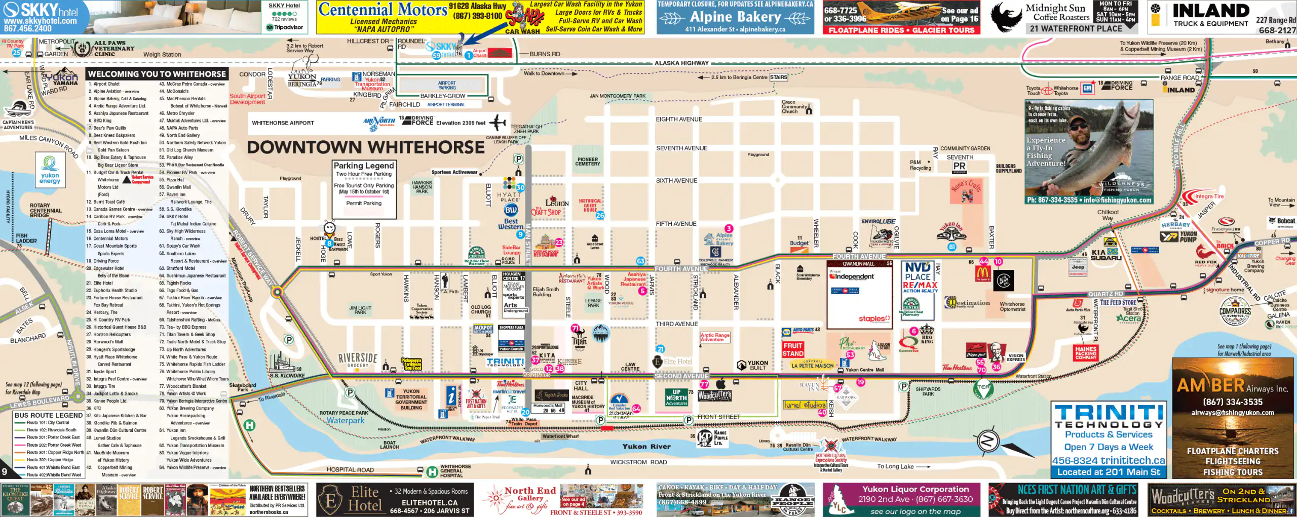
Downtown Whitehorse Map

The heart of the city, from the Yukon River up to Eighth Avenue. Compact, walkable, and clearly labeled.

Downtown essentials

Area covered Downtown core: from the Yukon River waterfront up to about Eighth Avenue, and from Taylor Street to Black Street approximately.
Best way to get around On foot. Almost everything is a 10–15 minute walk. There are bike lanes, and the waterfront is very comfortable on a bike.
Parking There are free two-hour zones and metered spots (1–3 hours depending on the street). In summer (May 15 to October 1) the map marks free tourist parking. Always check the signs — rules change.
Buses The color legend on the map shows the routes that serve downtown. Most main lines touch Second or Fourth Avenue.
River and waterfront The waterfront walkway runs parallel to Front Street. It’s the best place to walk with river views and easy access to the rest of downtown.

Find your Yukon

Discover the beauty and diversity of the Yukon, from historic gold rush towns to
untouched wilderness and winding highways.

Rest Easy,
Yukon Style

From cozy cabins to modern hotels, find the perfect place to unwind after your northern adventures.

Treat yourself to Yukon Flavour

Experience the Yukon’s welcoming restaurants, cafés, and local flavours.

Adventure
awaits

Hike, paddle, sightsee, and discover, explore the Yukon’s top attractions and activities.

Take a Piece of the Yukon Home

Browse local shops and artists offering everything from handmade crafts to northern keepsakes.

Everything you need is here

Find trusted Yukon businesses and local services for visitors, travelers, and residents.

Plan with
confidence

Maps, road reports, and travel info to help you navigate Yukon highways safely and
easily.

Events
calendar

Discover what’s happening across the North. Explore events by community or region and plan your northern adventure around local culture, music, and tradition.