
















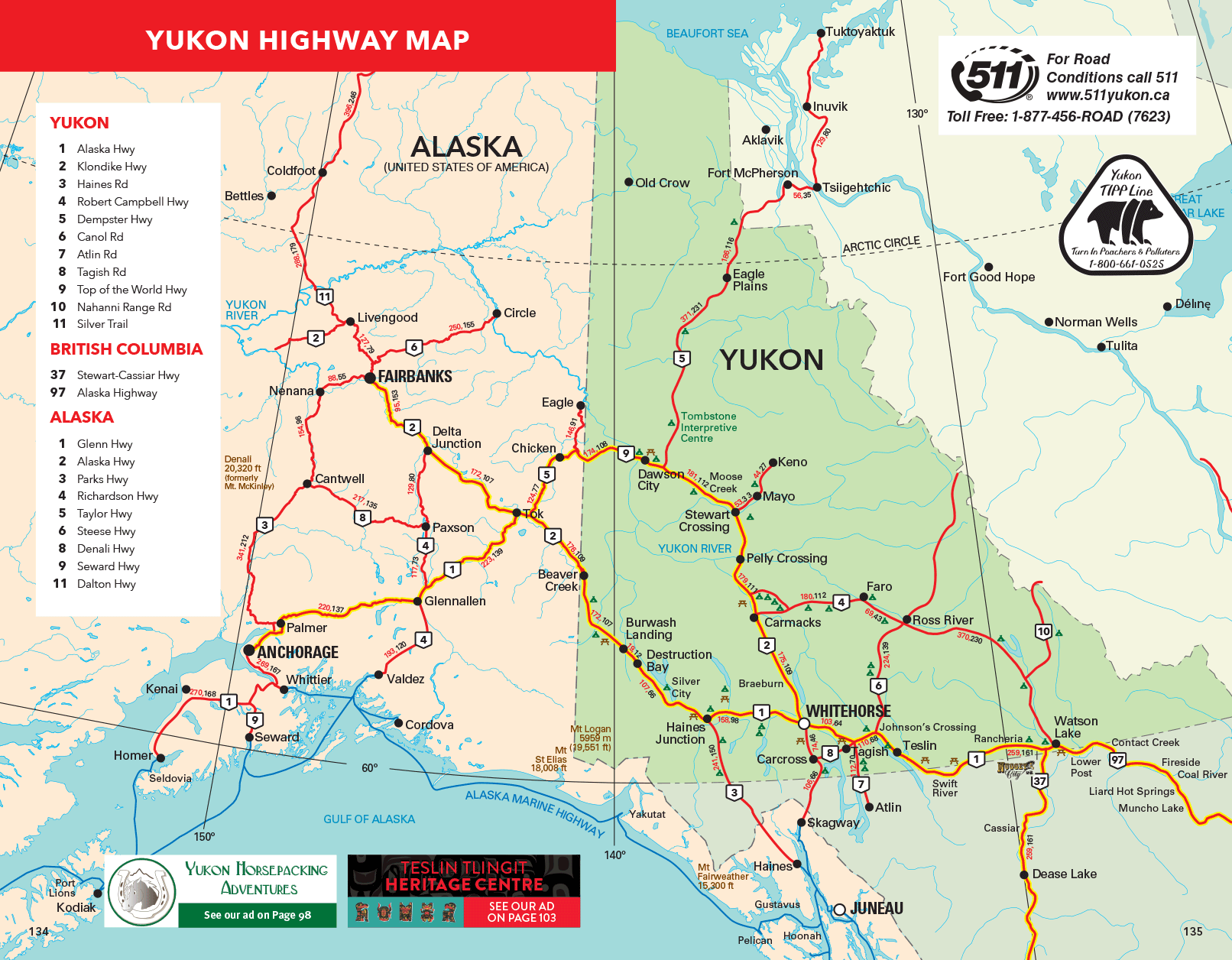
This map shows the Yukon's numbered highways, along with connecting roads in Alaska, northern British Columbia and the western Northwest Territories.
The legend lists eleven Yukon routes: the Alaska Highway (1), Klondike Highway (2), Haines Road (3), Robert Campbell Highway (4), Dempster Highway (5), Canol Road (6), Atlin Road (7), Tagish Road (8), Top of the World Highway (9), Nahanni Range Road (10) and Silver Trail (11). It also lists two British Columbia routes, the Stewart-Cassiar Highway (37) and the Alaska Highway (97), and nine Alaska highways.
Yukon communities on the map include Whitehorse, Dawson City, Watson Lake, Teslin, Carcross, Haines Junction, Destruction Bay, Burwash Landing, Beaver Creek, Carmacks, Pelly Crossing, Stewart Crossing, Mayo, Keno, Faro, Ross River, Eagle Plains and Old Crow. Beyond the Yukon it marks Inuvik and Tuktoyaktuk at the north end of the Dempster, plus Skagway, Haines, Atlin and Dease Lake. For road conditions, the map points to 511 Yukon: dial 511, visit 511yukon.ca or call toll-free 1-877-456-ROAD (7623). To learn more about each road, see our guide to Yukon highways.