




































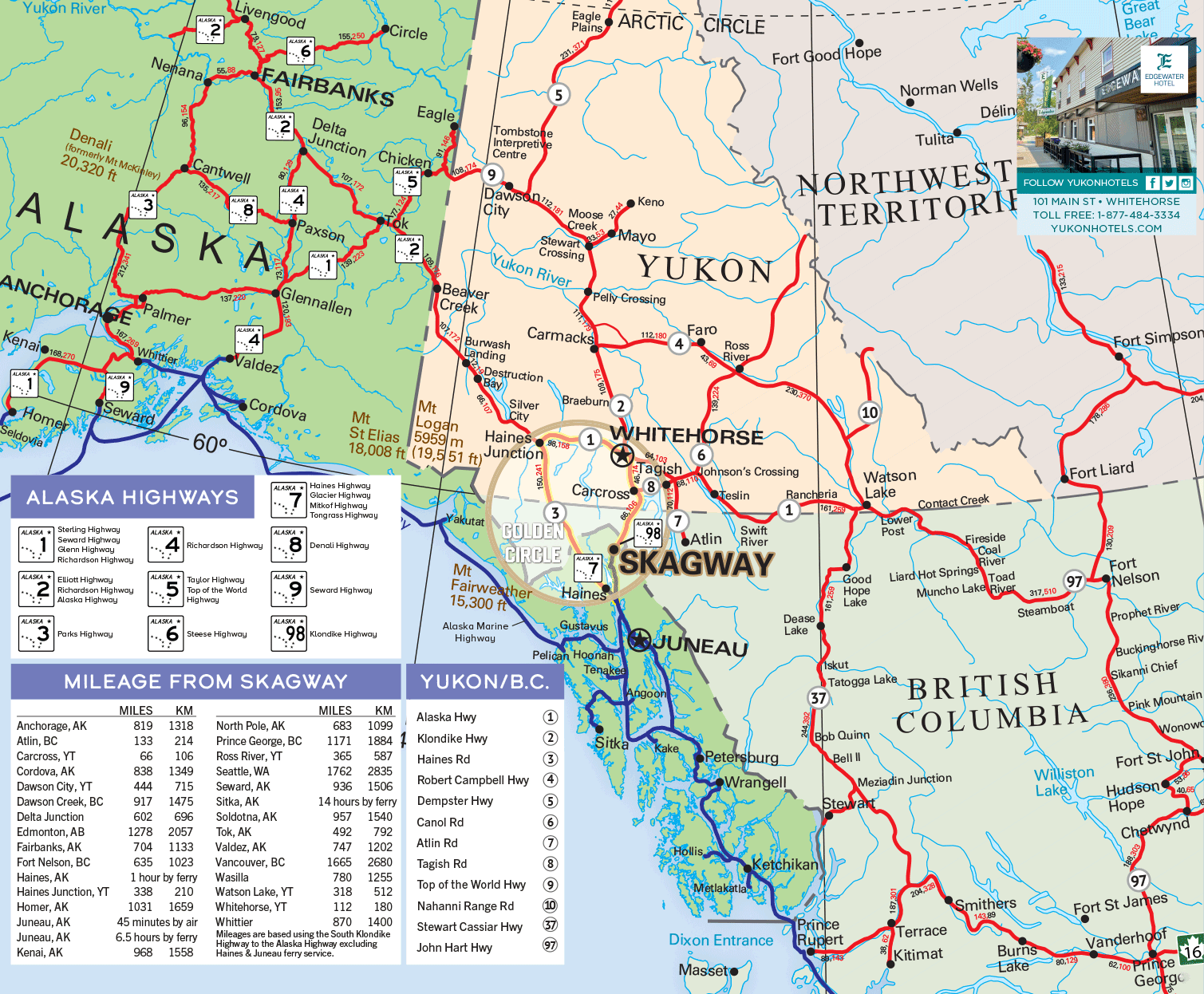
This map shows the road network of the Yukon, Alaska and northern British Columbia, with a table of driving distances from Skagway, Alaska.
The Alaska Highway appears as route 1 in the Yukon, running from Watson Lake through Teslin, Whitehorse, Haines Junction, Destruction Bay, Burwash Landing and Beaver Creek to the Alaska border, then on to Tok, Delta Junction and Fairbanks. In British Columbia it passes Fort Nelson and Fort St. John. Other roads include the Stewart-Cassiar, Klondike and Haines routes, plus the Golden Circle loop and Alaska Marine Highway ferry routes.
Today the Alaska Highway is about 2,232 km (1,387 miles) long, from Mile 0 in Dawson Creek, B.C., to Delta Junction, Alaska. Its Yukon section, signed as Yukon Highway 1, runs about 930 km from the B.C. border at km 968 to the Alaska border at km 1902. The Skagway table lists Whitehorse at 112 miles (180 km) and Dawson Creek at 917 miles (1,475 km), measured via the South Klondike Highway. For stops, distances and road-condition links along the route, see our Alaska Highway guide.