Golden Circle Route: Whitehorse, Skagway, Haines and Haines Junction

A paved loop of about 568 km (353 mi) through Yukon, British Columbia and Alaska, with a one-hour state ferry between Skagway and Haines. Open all year; two border crossings, neither open 24 hours.
The Golden Circle Route links Whitehorse, Carcross, Skagway, Haines and Haines Junction on three highways, with a short Alaska Marine Highway ferry between Skagway and Haines. The towns are only about 13 nautical miles apart by water, but there is no road between them.
All of the driving is paved and open year-round. You cross the Canada–US border twice and neither crossing is open 24 hours — and the ferry is the only way to take a vehicle from Skagway to Haines, so book it before setting your other dates.
AT A GLANCE

Quick overview

DistanceAbout 568 km (353 mi) + Skagway–Haines ferry (~13 nautical miles)
Time needed~8 hours of driving; most take 3–5 days
HighwaysSouth Klondike Hwy · Haines Hwy (Haines Road) · Alaska Hwy
BordersTwo crossings, neither 24 h — open ~7 a.m.–11 p.m. Alaska time
FerryAlaska Marine Highway, ~1 hour; book ahead for vehicles (AMHS)
RoadPaved throughout; steep grades over White Pass (1,003 m) and Chilkat Pass (~1,070 m)
Longest fuel gapHaines Junction → 33 Mile Roadhouse, ~185 km (115 mi)
SeasonOpen year-round; June–September is busiest
Time zonesYukon/B.C. UTC−7; Alaska 1 h behind in summer, 2 h in winter
Conditions511 Yukon · Alaska 511 · DriveBC
COUNTER-CLOCKWISE FROM WHITEHORSE

The drive, leg by leg

Five segments, three highways and one ferry. The loop works the same clockwise; you just take the ferry from Haines to Skagway.
LEG 1

Whitehorse to Carcross

About 70 km (43 mi)
Alaska Highway south, then the South Klondike Highway past Emerald Lake and the Carcross Desert.
LEG 2

Carcross to Skagway

About 106 km (66 mi)
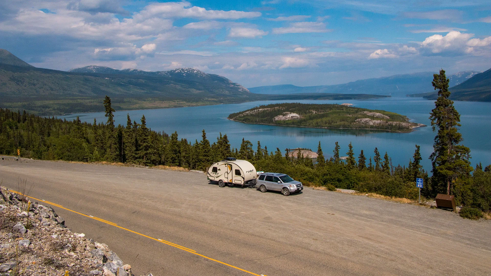
Bove Island, Tutshi Lake and the Yukon Suspension Bridge, then over White Pass and down to sea level. No fuel until Skagway.
Car and travel trailer at the Bove Island viewpoint above Windy Arm of Tagish Lake on the South Klondike Highway
Skagway, Alaska
LEG 3

Skagway to Haines

~13 nautical miles, about 1 hour
Alaska Marine Highway ferry up Lynn Canal — the only way to take a vehicle between the two towns.
LEG 4

Haines to Haines Junction

About 238 km (148 mi)
Through the Chilkat Bald Eagle Preserve and over Chilkat Pass, past Million Dollar Falls, Klukshu and Kathleen Lake.
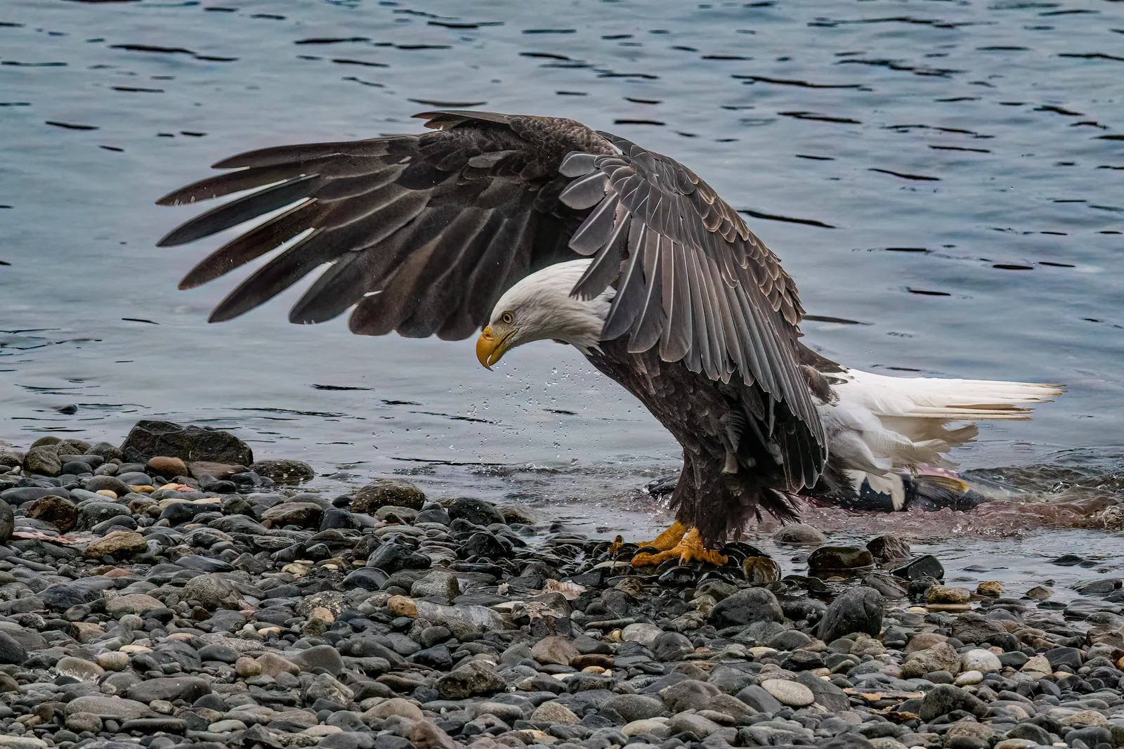
A bald eagle with its wings spread stands over a salmon on a gravel riverbank.
Village of Haines Junction, Yukon
LEG 5

Haines Junction to Whitehorse

About 154 km (96 mi)
Alaska Highway east past Pine Lake, the Otter Falls Cutoff and the Takhini River.
SAMPLE ITINERARY

Day by day

A four-day plan with two nights in Alaska. Adjust around your ferry booking.
Day 1

Whitehorse to Skagway, about 176 km

Emerald Lake, Carcross Desert and Carcross (last fuel), then over White Pass to Skagway. Clear US customs at km 11.
Day 2

Skagway, then the ferry to Haines

Once the starting point for more than 40,000 gold-rush stampeders headed to the Yukon in search of gold. Quaint false-front shops and restored buildings stretch for seven blocks along Broadway Street, all of which is part of the Klondike Gold Rush National Historical Park. Stroll the wooden sidewalks, visit one of the local museums, or take one of the many adventure tours offered. When you go to take the AMHS ferry make sure to check-in 1.5 hours before scheduled departure time.
Day 3

Haines to Haines Junction, about 238 km

Fill up in Haines, watch for eagles along the Chilkat, clear Canada customs at Pleasant Camp and cross Chilkat Pass into Kluane country.
Day 5

Haines Junction to Whitehorse, about 154 km

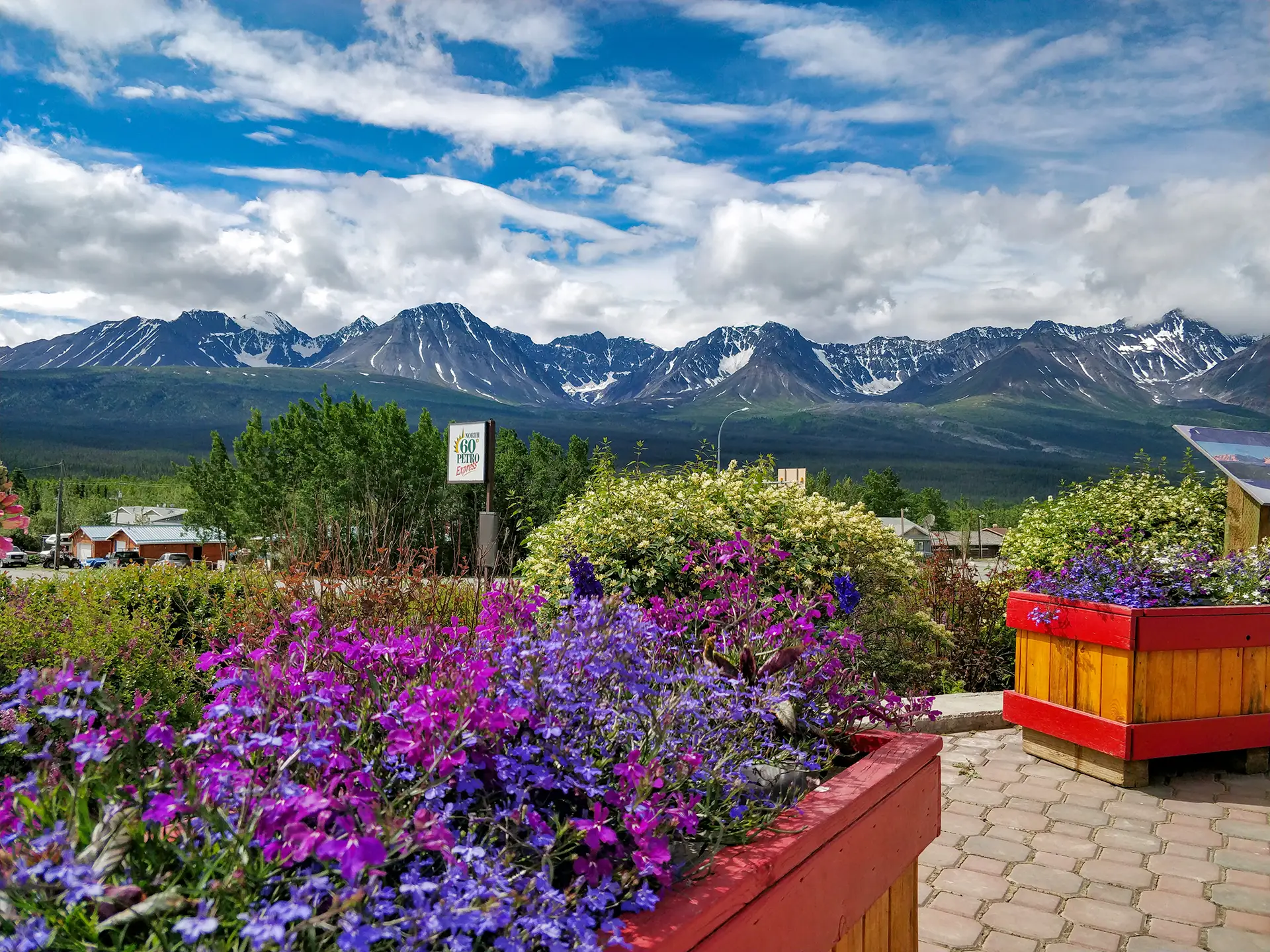
Haines Junction serves as the hub of the Kluane region with the national park headquarters and a range of visitor services. Wilderness excursions can include river rafting, canoeing, hiking, fishing, horseback riding and glacier flightseeing. Make the 152 mile drive south to Haines located across the Canadian Border. The drive takes you through Tatshenshini-Alsek Park and Kluane National Park and Reserve (part of the largest internationally protected area in the world) with many mountain trails, lakes and rivers to explore.
Be sure to visit the Dakų Cultural Centre, then an easy Alaska Highway drive home past Pine Lake and Otter Falls. 
Shorter or longer
• 3 days: Skagway day 1, morning ferry day 2, drive straight through to Whitehorse day 3 (~392 km).
• 5 days: add hiking in Kluane National Park or fall eagle viewing in Haines.
• Side trips: Tagish Road and the Atlin Road to Atlin, B.C. Or continue from Haines Junction on the Klondike Kluane Loop.
BEFORE YOU GO

Borders, ferry & timing

Border crossings

• Counter-clockwise: Skagway (US) and Pleasant Camp (Canada). Clockwise: Dalton Cache (US) and Fraser (Canada).
• Each crossing is effectively open 7 a.m.–11 p.m. Alaska time; arrive late and you wait until morning.
• Everyone needs a passport or accepted document (NEXUS, US passport card, enhanced licence).

Ferry notes

• Book the AMHS sailing first: 1-800-642-0066.
• Drivers check in 1.5 h before in Skagway, 2 h in Haines.
• Haines Skagway Fast Ferry and Fjord Express to Juneau are passenger-only.

When to go

• June–August: longest days, everything open, busiest roads and ferries.
• May & September: quieter shoulder months.
• Mid-October–January: 3,000+ bald eagles at the Chilkat Council Grounds.
• Winter: plowed and open, but passes can close in storms.

Where to stay

• Whitehorse: Edgewater, Gold Rush Inn, Sternwheeler, Skky Hotel…
• Carcross: Caribou Hotel, Chilkoot Cabins, Southern Lakes Resort
• Skagway: Historic Skagway Inn, At the White House, Skagway Bungalows
• Haines Junction: Alcan Motor Inn, Raven’s Rest Inn, Cozy Corner Motel
• Campgrounds: Conrad, Million Dollar Falls, Dezadeash Lake, Kathleen Lake, Pine Lake
COMMON QUESTIONS

Frequently asked questions

What is the Golden Circle Route?

A loop of about 568 km (353 mi) linking Whitehorse, Carcross and Skagway on the South Klondike Highway, a ferry from Skagway to Haines, and the Haines Highway and Alaska Highway back through Haines Junction to Whitehorse.

How long does the Golden Circle Route take?

About 8 hours of driving without stops, plus about 1 hour on the ferry and time for check-in and customs. Most people take 3 to 5 days.

Can you drive from Skagway to Haines?

No. There is no road between them. The Alaska Marine Highway ferry carries vehicles between the two towns in about an hour. Driving around would mean going back through Whitehorse and Haines Junction, about 568 km.

Do I need to book the Skagway–Haines ferry?

Yes, for a vehicle. Book with the Alaska Marine Highway System before you fix your other dates. Drivers check in 1.5 hours before departure in Skagway and 2 hours before in Haines.

Are the border crossings open 24 hours?

No. On both the South Klondike and Haines highways the US and Canadian ports are open from 7 a.m. to 11 p.m. Alaska time. On the Canadian clock that is 8 a.m. to midnight in summer and 9 a.m. to 1 a.m. from November 1, 2026 to March 14, 2027.

What documents do I need?

A valid passport or another accepted document, such as a NEXUS card, a US passport card or an enhanced driver’s licence, for everyone in the vehicle. Some visitors also need a visa or an ESTA.

Where is the longest stretch without gas?

Between Haines Junction and the 33 Mile Roadhouse on the Haines Highway, about 185 km (115 mi). There is no fuel on the Canadian section of the Haines Road, so fill up in Haines Junction or Haines.

Is the Golden Circle Route paved and open in winter?

Yes. All of it is paved and the highways are open all year. White Pass and Chilkat Pass get heavy snow, and storms or avalanche control can close the road. The ferry runs less often in winter.

Can I visit Juneau from Skagway or Haines?

Yes, as a passenger. No road reaches Juneau. In summer, the Fjord Express to Juneau runs passenger-only day trips from Skagway and Haines with about 4 hours in Juneau; it does not carry vehicles. The Alaska Marine Highway also sails to Juneau and does carry vehicles.

Is there a time change?

Yes. Yukon and B.C. are on UTC-7 all year. Alaska is 1 hour behind in summer and 2 hours behind in winter, so you change your watch at each border.

Find your Yukon

Discover the beauty and diversity of the Yukon, from historic gold rush towns to
untouched wilderness and winding highways.
Rest Easy,
Yukon Style

From cozy cabins to modern hotels, find the perfect place to unwind after your northern adventures.

Treat yourself to Yukon Flavour

Experience the Yukon’s welcoming restaurants, cafés, and local flavours.

Adventure
awaits

Hike, paddle, sightsee, and discover, explore the Yukon’s top attractions and activities.

Take a Piece of the Yukon Home

Browse local shops and artists offering everything from handmade crafts to northern keepsakes.

Everything you need is here

Find trusted Yukon businesses and local services for visitors, travelers, and residents.

Plan with
confidence

Maps, road reports, and travel info to help you navigate Yukon highways safely and
easily.

Events
calendar

Discover what’s happening across the North. Explore events by community or region and plan your northern adventure around local culture, music, and tradition.