Klondike Kluane Loop: Whitehorse, Dawson City, Tok and Haines Junction

A summer road trip of about 1,445 km (898 mi) from Whitehorse to Dawson City, over the Top of the World Highway to Tok, Alaska, and back past Kluane Lake. Open late May to mid-September, when the Poker Creek border is open.
The Klondike Kluane Loop is a circle route of about 1,445 km (898 mi) through central and southwest Yukon and a corner of eastern Alaska. From Whitehorse it follows the North Klondike Highway to Dawson City, crosses the Yukon River on the free George Black ferry, and takes the Top of the World Highway and Alaska's Taylor Highway to Tok. The Alaska Highway then brings you back into Canada at Beaver Creek, along Kluane Lake and through Haines Junction to Whitehorse. Some people call it the Klondike Kluane Circle.
It is a summer trip. The Top of the World border crossing opens only from late May to mid-September, in daytime, and much of the road between Dawson City and Chicken, Alaska, is gravel. Fuel stops are far apart in three places. Plan at least 7 days.
At a glance

Quick overview

DistanceAbout 1,445 km (898 mi) return from Whitehorse, including the side trip to Tok (19 km each way). About 1,407 km (874 mi) if you skip Tok.
Time needed7 to 10 days. Whitehorse to Dawson City is about 6 hours without stops; Dawson City to Tok takes most of a day.
HighwaysNorth Klondike Highway · Top of the World Highway · Boundary Spur Road and Taylor Highway (Alaska Route 5) · Alaska Highway
BordersPoker Creek / Little Gold Creek (Top of the World): summer only — in 2026, May 22 to September 15, 9 a.m.–7 p.m. Yukon time. Beaver Creek and the US Alcan Border station on the Alaska Highway: open 24 hours, all year.
FerryGeorge Black ferry at Dawson City — free, no booking, mid-May to mid-October, usually 24 hours (Yukon ferries).
RoadMostly paved. Gravel on the Top of the World Highway and on the Taylor Highway from Jack Wade Junction to near Chicken. Frost heaves are common on the Alaska Highway north of Kluane Lake.
Fuel gapsWhitehorse–Carmacks ~180 km (Braeburn closed May 2026) · Dawson City–Chicken ~175 km (seasonal fuel in Chicken) · Burwash Landing–Beaver Creek ~171 km. Naabia Niign at Northway Junction (Mile 1264) is the fuel stop between Tok and Beaver Creek.
SeasonFull loop late May to mid-September. Top of the World and Taylor highways are not maintained in winter.
TimeYukon stays on UTC−7. In summer Alaska is one hour behind.
Conditions511 Yukon · Alaska 511
CLOCKWISE FROM WHITEHORSE

The drive, leg by leg

The legs below run clockwise from Whitehorse. Driving it the other way works too, but you still need to cross at Poker Creek during its summer hours.
Leg 1

Whitehorse to Carmacks

About 180 km (112 mi)
Alaska Highway 14 km, then the North Klondike past Lake Laberge, Fox Lake and Twin Lakes. First fuel in Carmacks — Braeburn is closed.
Leg 2

Carmacks to Dawson City

About 355 km (221 mi)
North Klondike Highway past Five Finger Rapids, Pelly Crossing, Stewart Crossing and Tintina Trench into Dawson City.
Leg 3

Dawson City to Tok

About 300 km (187 mi)
Free George Black ferry, Top of the World Highway to Poker Creek, then Boundary Spur and the Taylor Highway via Chicken to Tetlin Junction and Tok.
Leg 4

Tok to Beaver Creek

About 163 km (101 mi)
Alaska Highway east past Tetlin Junction and Naabia Niign fuel, through the Alcan Border station and back into Canada at Beaver Creek. Set clocks forward 1 hour.
Leg 5

Beaver Creek to Haines Junction

About 293 km (182 mi)
Alaska Highway along frost heaves to Burwash Landing and Destruction Bay, then the full length of Kluane Lake past Soldier's Summit into Haines Junction.
Leg 6

Haines Junction to Whitehorse

About 154 km (96 mi)
Alaska Highway east past Pine Lake, the Otter Falls Cutoff and the Takhini River back to Whitehorse.

SAMPLE ITINERARY

Day by day

This is an 8-day plan with two full days off the road. Shorter and longer options follow.
D1

Whitehorse to Pelly Crossing or Moose Creek

Fill up in Whitehorse; first fuel Carmacks (~180 km). Stops at Laberge, Fox Lake, Twin Lakes and Five Finger Rapids.
D2

On to Dawson City

Fuel at Stewart Crossing; Tintina Trench rest area; Dempster Corner cardlock; arrive Dawson City with a full tank.
D3

Dawson City

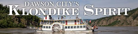
Parks Canada historic sites, Klondike Spirit cruise option, museums and Diamond Tooth Gertie's. Fill up before the ferry.
D4

Dawson City to Tok, about 300 km

George Black ferry, Top of the World to Poker Creek (arrive before 7 p.m. Yukon time), Taylor Highway via Chicken to Tok.
D5

Tok to Destruction Bay, about 350 km

Fuel at Naabia Niign; Alcan and Beaver Creek borders; frost heaves to Burwash Landing; overnight Destruction Bay.
D6

Kluane Lake to Haines Junction

Congdon Creek, Thechàl Dhâl / Soldier's Summit and the Kluane Lake viewpoint; overnight Haines Junction.
D7

Kluane National Park and Reserve

Trail and bear info at Da Ku Cultural Centre; Kathleen Lake ~27 km south on the Haines Road.
D8

Haines Junction to Whitehorse, about 154 km

Easy Alaska Highway drive home past Pine Lake, Otter Falls Cutoff and the Takhini River.
Shorter or longer
• 6 days: Whitehorse to Dawson City in one day (~535 km) and skip the Kluane day.
• 10 days: add a second day in Dawson City, or side-trip the Dempster to Tombstone or the Silver Trail to Keno City.
• Link with the Golden Circle: from Haines Junction continue to Haines, the ferry to Skagway and back to Whitehorse.
BEFORE YOU GO

Borders, ferry & timing

Border crossings

• Poker Creek / Little Gold Creek (Top of the World): summer only — 2026 May 22–Sep 15, 9 a.m.–7 p.m. Yukon time.
• Alcan (US) and Beaver Creek (Canada) on the Alaska Highway: 24 hours, all year.
• Clockwise: enter US at Poker Creek, return at Beaver Creek. Counter-clockwise: reach Poker Creek before 6 p.m. Alaska time.
• Everyone needs a passport or accepted document. No cannabis or Canadian firewood across the border.

Ferry notes

• George Black ferry at Dawson City: free, no reservations.
• Usually 24 hours, mid-May to mid-October (Yukon ferries).
• Yukon River Campground is at km 0.3 on the Top of the World side.

When to go

• Full loop only late May to mid-September while Poker Creek is open.
• June–August: longest days, every service open; gravel can be dusty or soft after rain.
• Late August–September: fall colour, fewer people; some services close early.
• Winter: North Klondike and Alaska Highways stay open; Top of the World and Taylor are not maintained.

Where to stay

• Book Dawson City early for July and August.
• Key hubs: Whitehorse, Carmacks/Pelly/Moose Creek, Dawson City, Tok, Beaver Creek, Destruction Bay, Haines Junction.
• Campgrounds include Congdon Creek (electric fence), Yukon River (West Dawson), Pine Lake and BLM sites on the Taylor Highway.
COMMON QUESTIONS

FAQ

What is the Klondike Kluane Loop?

A circle route of about 1,445 km (898 mi) from Whitehorse to Dawson City on the North Klondike Highway, over the Top of the World Highway and Taylor Highway to Tok, Alaska, and back through Beaver Creek, Kluane Lake and Haines Junction to Whitehorse. Also called the Klondike Kluane Circle.

How many days do I need for the Klondike Kluane Loop?

At least 7 days, and 8 to 10 if you want full days in Dawson City and Kluane National Park and Reserve. Whitehorse to Dawson City alone is about 6 hours without stops.

When can you drive the Klondike Kluane Loop?

Only when Poker Creek / Little Gold Creek is open. In 2026 that was May 22 to September 15, 9 a.m. to 7 p.m. Yukon time. 2027 dates not announced.

Is the Top of the World Highway paved?

Only in parts. Yukon section is mostly gravel with some paved stretches. Taylor Highway is gravel from Jack Wade Junction to near Chicken and paved for its last 60 miles.

Where can I get gas on the loop?

Whitehorse, Carmacks, Pelly Crossing, Stewart Crossing, Dempster Corner cardlock, Dawson City, Chicken (summer), Tok, Naabia Niign (Mile 1264), Beaver Creek, Burwash Landing, Destruction Bay and Haines Junction. Longest gaps ~180 / ~175 / ~171 km.

Do I need a passport for the Klondike Kluane Loop?

Yes. You cross into Alaska and back. Everyone needs a valid passport or another accepted document. Some visitors also need a US I-94 or an ESTA.

Does the George Black ferry cost anything?

No. Free, no reservations. Usually 24 hours a day from mid-May to mid-October.

Which direction is best?

Clockwise from Whitehorse lets you leave Dawson City in the morning and reach Poker Creek during daytime hours. Counter-clockwise works if you reach the border from Alaska before 6 p.m. Alaska time.

Is there a time change on the loop?

Yes. Alaska is 1 hour behind Yukon in summer. Set your watch back at Poker Creek and forward again near Beaver Creek.

What services are in Tok?

Fuel, groceries, motels, RV parks and restaurants. Tok Cut-Off leaves for the Glenn Highway to Anchorage. Sourdough Campground café (summer) and Fast Eddy's (year-round) for breakfast.

Find your Yukon

Discover the beauty and diversity of the Yukon, from historic gold rush towns to
untouched wilderness and winding highways.

Rest Easy,
Yukon Style

From cozy cabins to modern hotels, find the perfect place to unwind after your northern adventures.

Treat yourself to Yukon Flavour

Experience the Yukon’s welcoming restaurants, cafés, and local flavours.

Adventure
awaits

Hike, paddle, sightsee, and discover, explore the Yukon’s top attractions and activities.

Take a Piece of the Yukon Home

Browse local shops and artists offering everything from handmade crafts to northern keepsakes.

Everything you need is here

Find trusted Yukon businesses and local services for visitors, travelers, and residents.

Plan with
confidence

Maps, road reports, and travel info to help you navigate Yukon highways safely and
easily.

Events
calendar

Discover what’s happening across the North. Explore events by community or region and plan your northern adventure around local culture, music, and tradition.